Pyramids in Antarctica: Coincidence or Ancient Copy?
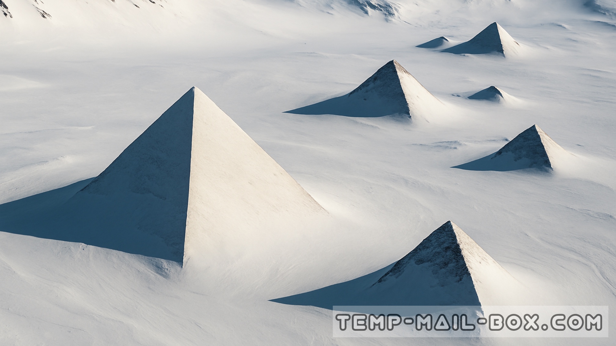
For decades Antarctica has been associated with endless ice sheets, extreme cold, and mystery. Yet among the most intriguing stories are those about pyramid-shaped structures that can be seen in satellite imagery of the frozen continent. At the coordinates 79°58'39.2"S, 81°57'32.2"W, researchers and enthusiasts have spotted a formation that looks surprisingly similar to the Great Pyramid of Giza. Its triangular geometry, four visible sides, and apparent orientation toward the cardinal directions provoke questions far beyond geology.
The formation, which some call the "Antarctic Pyramid," appears to rise with unusually sharp angles, giving it the appearance of a man-made structure rather than a simple mountain peak. In the surrounding area, several more protrusions can be seen, also resembling pyramids, creating the impression of a complex, not just a single anomaly. This resemblance to the Egyptian pyramids has fueled theories of lost civilizations, secret expeditions, and even ancient construction that predates recorded history.
Skeptics argue that these structures are nothing more than nunataks—mountain peaks that pierce through the thick Antarctic ice sheet. Erosion, wind, and layers of snow can give rocks surprisingly geometric shapes, especially when viewed from above. To many scientists, this is the most plausible explanation, and until thorough geological expeditions are carried out, the mystery remains speculative.
Still, the striking orientation and almost perfect triangular faces leave room for debate. Were these shapes a coincidence of natural forces, or do they suggest that Antarctica hides traces of an unknown past? The secrecy surrounding official commentary only adds fuel to speculation. For now, the "pyramids of Antarctica" continue to spark curiosity, blending the boundaries between science, mystery, and imagination.